
Earlier this week, NASA released an amazing photograph of an eruption of Sarychev Peak Volcano, taken by astronauts aboard the orbiting International Space Station (ISS). Seeing that great photo prompted me to dig into the archives and see what other imagery I could find from recent NASA archives. Collected here are a handful of photographs of Sarychev Peak Volcano, and more, taken by astronauts aboard the ISS over the past few months.
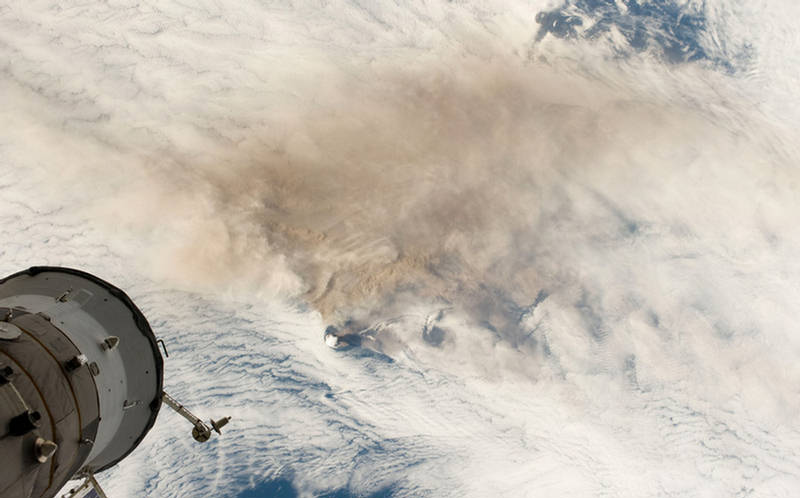
High above Russia's Kuril Islands, astronauts aboard the International Space Station (ISS) look down on erupting Sarychev Peak Volcano (plume in center, left) on Matua Island and its brownish ash mixing with cloud cover downwind on June 12, 2009. Part of the ISS, a Soyuz module, is visible in the foreground.
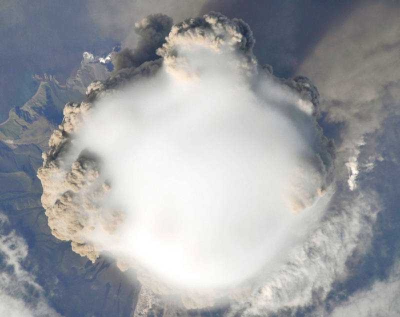
A closer look at Sarychev Peak Volcano reveals more detail, the circular hole in the clouds around the island, the smooth condensation cloud wrapping much of the ash plume
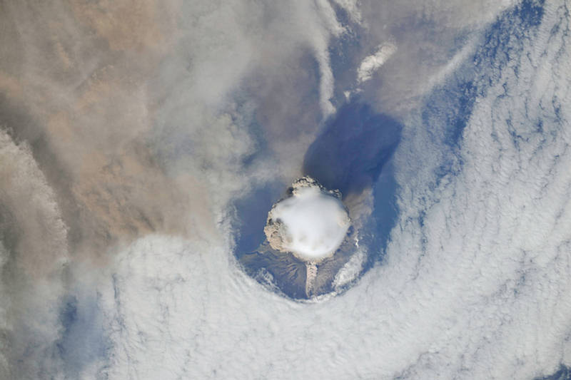
Closer still to Sarychev Peak Volcano, pyroclastic flows can be seen tumbling down its slope (lighter clouds, bottom). Also visible is a closer view of the condensation cloud or "pileus", formed by the rapidly rising plume.
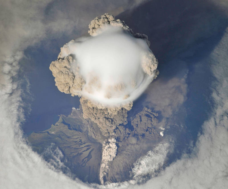
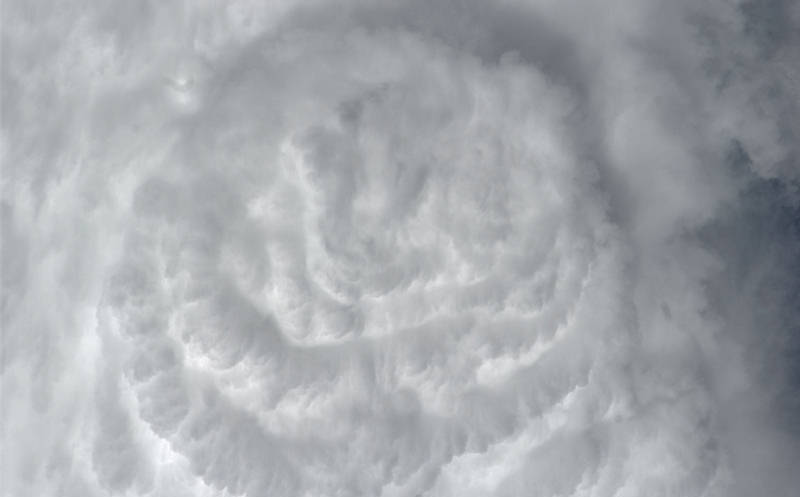
A view looking straight down at the top of the eruption plume of Sarychev Peak Volcano on June 12, 2009. Local winds were very light that day, and the eruption plume's upward motion was hardly disturbed at all
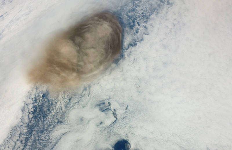
One day after its eruption pictured above, ash from Russia's Sarychev Peak Volcano mixes and ripples out into the surrounding clouds.
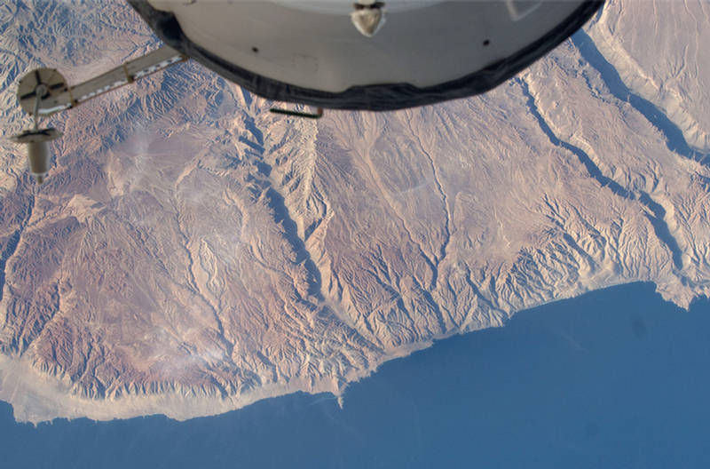
A view of the Pacific coast around Puerto Atico, Peru
Ahile above the Pacific Ocean on may 11, 2009, ISS astronauts shot this photo of a waning gibbous moon, slightly distorted, seen through the Earth's atmosphere.

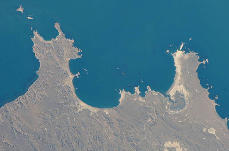
A view of the Atlantic Ocean alongside Bahia Oso Marino and Punta Buque, Argentina.
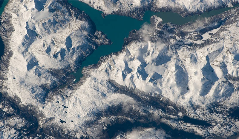
Lago Nansen, amongst the Andes Mountains in Argentina.
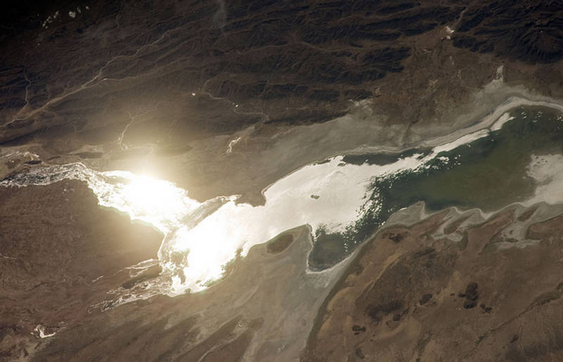
The sun glints off Lake Poopó in Bolivia. Lake Poopó is a 1,000 sq km saline lake lying 3,686 meters above sea level.
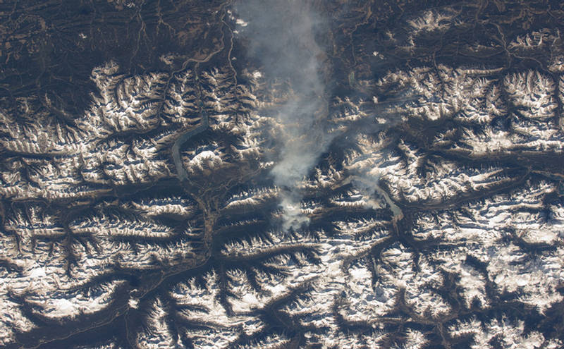
Smoke blows eastward from a mountain slope in Canada's Rocky Mountains near Banff and Canmore.
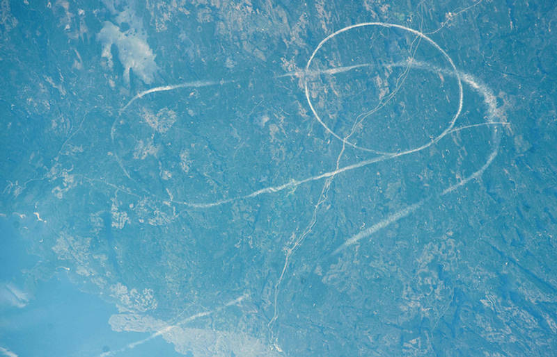
Circular Contrails are visible, east of Lake Nipigon, Canada.
Deep Convective Clouds, seen fromabove, over the Atlantic Ocean.
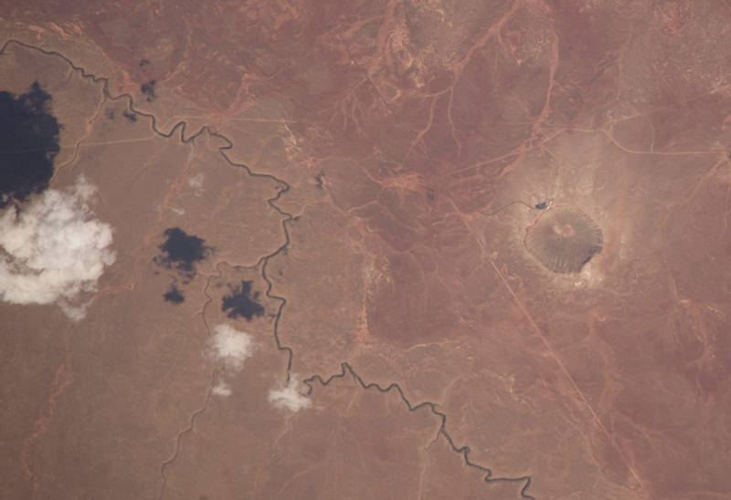
A few clouds in the sky above Arizona and its Barringer Impact Crater, at right.
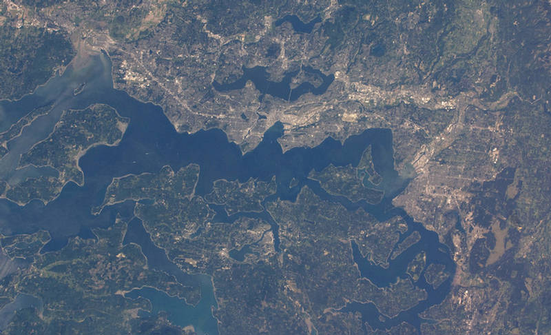
Washington State's Puget Sound, featuring Vashon Island, Seattle and Tacoma, viewed on May 29th, 2009
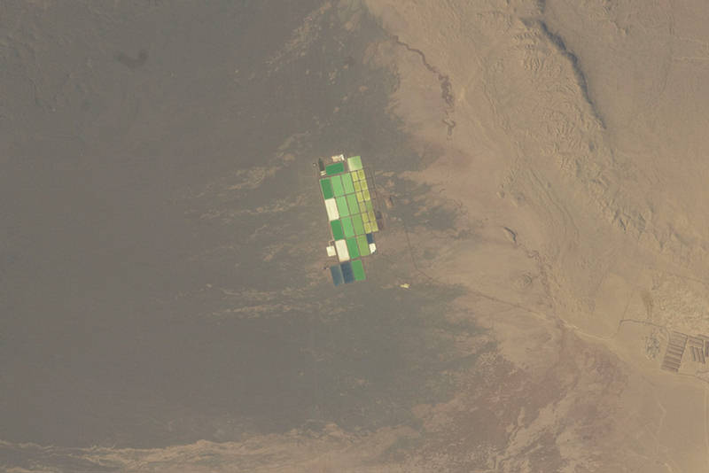
Evaporation ponds in Pampa Del Tamarugal, Chile.

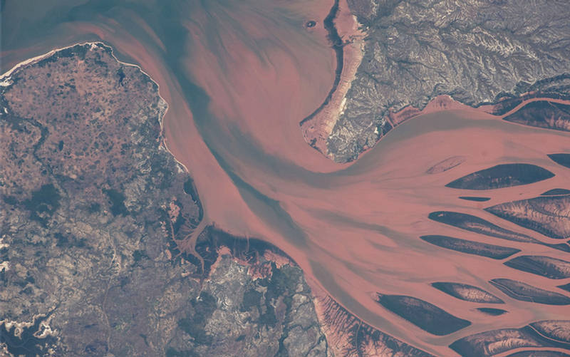
Betsiboka River delta, near Majunga, Madagascar.