The Lowest Continent Points Of The World
Australia Lake Eyre -15 m (-49 ft)Lake Eyre is the lowest point in Australia, at approximately 15 m (49 ft) below sea level, and, on the rare occasions that it fills, it is the largest lake in Australia. It is the focal point of the vast Lake Eyre Basin and is found some 700 km (435 mi) north of Adelaide.

Europe – Caspian Sea -28 m (-92 ft)
The Caspian Sea is the lowest point in Europe, at approximately 28 m (?92 ft) below sea level , and the largest enclosed body of water on Earth by area, variously classed as the world’s largest lake or a full-fledged sea. The sea has a surface area of 371,000 square kilometres (143,244 sq mi) and a volume of 78,200 cubic kilometres (18,761 cu mi). It is in an endorheic basin (it has no outflows) and is bounded by northern Iran, southern Russia, western Kazakhstan and Turkmenistan, and eastern Azerbaijan. It has a maximum depth of about 1,025 metres (3,363 ft).
South America – Laguna del Carbón 105 m (-344 ft
Laguna del Carbón is an endorheic salt lake in the Gran Bajo de San Julián (Great San Julián Depression) of Santa Cruz Province, Argentina, 54 km from Puerto San Julián. At 105 metres (340 ft) below sea level, it is the lowest point of South America . As in several other locations in Patagonia, dinosaur fossils have been found in the area
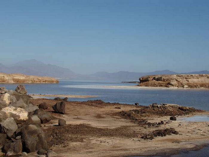
Africa – Lake Assal -155 m (-509 ft)
Lake Assal is a crater lake in central Djibouti, located at the southern border of Tadjoura Region. It lies 155 m (509 ft) below sea level in the Afar Depression and its shores comprise the lowest point on land in Africa and the second lowest land depression on Earth after the Dead Sea. It measures 19 by 7 km (4.3 mi) and has an area of 54 km2 (21 sq mi). The maximum depth is 40 m (130 ft), whereas the mean depth is 7.4 m (24 ft), which makes for a water volume of 400 million cubic metres (320,000 acre·ft). The catchment area measures 900 km2 (350 sq mi), and there is just a residual runoff of fresh water into the lake
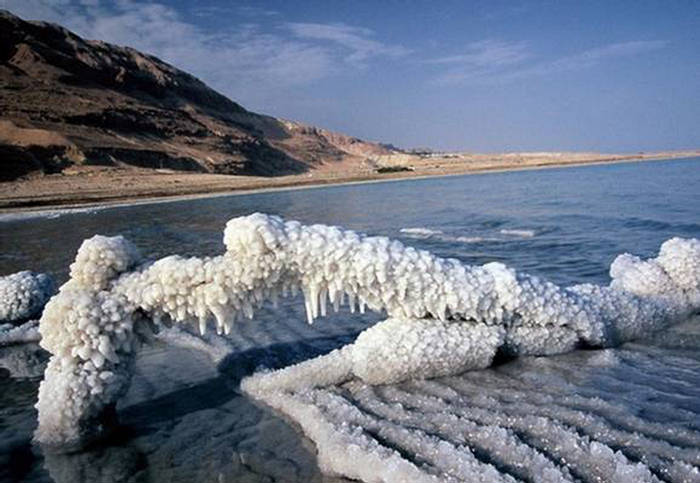
Asia – Dead Sea -422 m (?1,385 ft)
The Dead Sea also called the Salt Sea, is a salt lake in Jordan to the east and in the West Bank and Israel to the west. Its surface and shores are 422 metres (1,385 ft) below sea level, the lowest elevation on the Earth’s surface on dry land. The Dead Sea is 378 m (1,240 ft) deep, the deepest hypersaline lake in the world. It is also one of the world’s saltiest bodies of water, with 33.7% salinity. It have a higher salinity. It is 8.6 times more salty than the ocean. This salinity makes for a harsh environment where animals cannot flourish, hence its name. The Dead Sea is 67 kilometres (42 mi) long and 18 kilometres (11 mi) wide at its widest point. It lies in the Jordan Rift Valley, and its main tributary is the Jordan River.
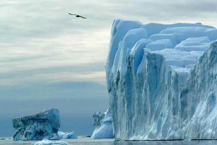
North America – Jakobshavn Isbræ -1,512m (-4.960 ft)
Jakobshavn Isbræ drains 6.5% of the Greenland ice sheet and produces around 10% of all Greenland icebergs. Some 35 billion tonnes of icebergs calve off and pass out of the fjord every year. Icebergs breaking from the glacier are often so large (up to a kilometer in height) that they are too tall to float down the fjord and lie stuck on the bottom of its shallower areas, sometimes for years, until they are broken up by the force of the glacier and icebergs further up the fjord. Studied for over 250 years, Jakobshavn Isbræ has helped develop our understanding of climate change and icecap glaciology.
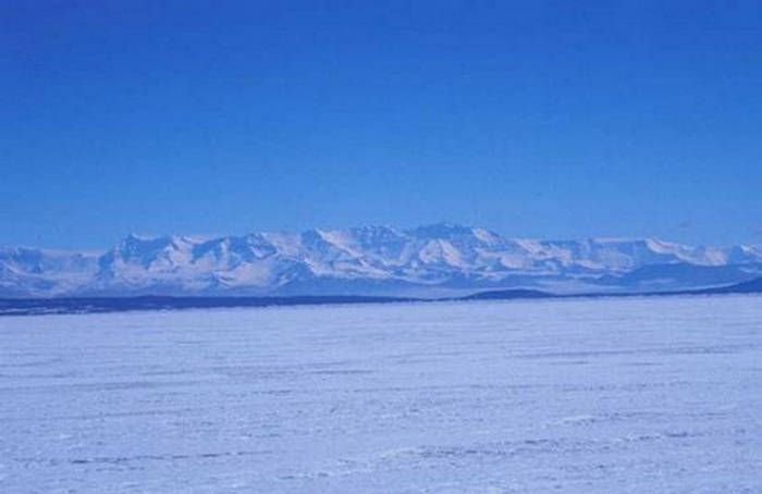
Antarctica – Bentley Subglacial Trench -2,555 meters (-8,327 ft)
he Bentley Subglacial Trench is a vast trench in Antarctica. At 2,555 meters (8,327 ft) below sea level, it is the lowest point on the surface of the earth not covered by ocean, although it is covered by ice. Most people do not count it as the lowest point on land, since the ice makes it essentially subterranean. Also, if the ice melted, the area would be under water. The trench’s size is similar to that of Mexico.
The trench was named after Charles Bentley in 1961, who was the geophysicist and led the scientific expedition in Antarctica in 1957-58 that led to its discovery.