Post
by chandoo » Apr 04, 2008 Views: 2807
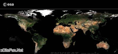
The European Space Agency's GlobCover project has revealed the most detailed portraits ever of the Earth's land surface. Using around 40 Terabytes of images (an amount of data equivalent to the content of 40 million books) taken from the ESA's Envisat, the maps, ten times sharper than anything produced previously, the GlobCover maps will have numerous uses, including plotting worldwide land use trends, studying natural and managed ecosystems and modelling climate change extent and impacts.
Bimonthly global composites for May to June 2005 and March to April 2006 can be accessed through a newly developed map server tool on ESA’s GlobCover website. On 19 June, additional bimonthly global composites will be made available as well as the first part of a global land cover map over Eurasia.